Save big on hiking adventures!
Bukit Chenuang Hike
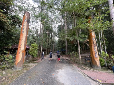
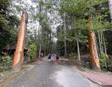
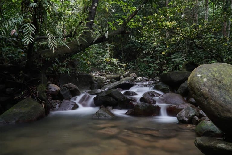
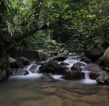
Bukit Chenuang Hike a moderate challenging, 6 - 7 hour with almost 7km hike near Sungai Congkak, Ulu Langat, Selangor. The hike to Bukit Chenuang begins at the parking lot next to the Sungai Congkak Resort / Chenuang Peak Trail featuring lush rainforest trails, river crossings. The mountain is located near Ulu Langat next to many popular nature spots such waterfalls and mountains like Gunung Nuang and Gunung Hitam. Many people spend a full day here and spend 2-3 hours enjoying swimming in the Sungai Congkak water falls. Its a best place to hike and swim before heading back to the city.
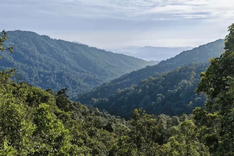
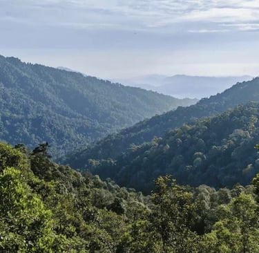
The first part of the trail follows Sungai Congkak before reaching the campsite. The trail passes through Campsite Zone 5, which is a popular spot for camping. Along the way, hikers will need to cross the river and be mindful of leeches and other dangers. After passing the rivers, hikers will begin to climb the steep terrain to reach the peak. The climb can be challenging and slippery, so proper hiking shoes is necessary. Once hikers reach the peak, they will be rewarded with a breathtaking view, especially during sunset and sunrise. Please bring gloves for root climbing, wear appropriate shoes, bring a raincoat and the trail can be muddy and slippery especially after rain.
Hike Overview
Permit : Compulsory.
Guide : Compulsory MGP Selangor (Can get from GEC MGP Selangor).
Location : Sungai Congkak, Ulu Langat, Selangor.
Duration : 6-7 hours.
Distance : 12km.
Height : 850 m / 2,788 ft
Difficulty : Moderate.
Categories : Hiking & Outdoor.
Language : Guide in English & Malay.
Itinerary
7:00am – Assemble at parking - Sungai Congkak Resort.
7:15am – Safety briefing, gear check & warm-up.
7:30am. – Start hiking to trailhead.
10:45 - 11.00am – Target to reach the summit. Spend 45minutes to 1 hour to enjoy the summit and have lunch. Taking summit pictures.
11.45am – Start descending slowly and be careful.
1.30pm to 2:00pm – Exit at Trailhead / Parking Area. End of Hike & Journey Home.
Includes
Licensed MGP Guide
Forestry Permit
Trip Management & Coordination
Basic First Aid Support
Digital E-Certificate
Excludes
Hikers’ Personal Accident (PA) Insurance.
Porter Services
Meals (Snack /Breakfast / Lunch)
Personal Expenses
Any items not specifically mentioned above.
Important Notes
Gear
Food, Snacks and Energy Bars (Himalayan Salt / Electrolytes)
Drinking Water 2 Litres.
Isotonic Drinks
Hiking Apparels - Long Pants, Long Sleeve T-shirts, Hiking Boots, Caps.
Hiking Backpack (20-30L)
Head lamp (Emergency)
Waterproof Jacket / Raincoat
Dry bags
Mosquito or leech repellent
Wet / dry tissues
Sun hat / cap & sunscreen
Working Gloves.
Hiking poles.
Extra clothes for change / toiletries / towel / Sandals / Plastic bags.
More NotesSafety & Risk - Hiking involves inherent risks such as slips, falls, fatigue, wildlife encounters, and changing weather conditions.
We limit the participants age Min 10 years to 75 years old.
Must be medically fit and ready for the challenge.
Personal Data - We need some info for permit application - Name, IC / Passport No, Address, Contact no and Emergency Contact No.
Insurance - Please consider purchasing Hiking Insurance.
No Refund will be entertained upon issuance of permit. All fees must be paid together with the google forms.
This tentative schedule is for guidance only and may change depending on actual conditions, including traffic delays, weather conditions, varying group pace, or delays by participants.
All real-time updates and changes will be communicated through a designated WhatsApp group.
Meeting Point - Parking Area Gap Gus Trail Head.Write your text here...
Contact Us Today
For any enquiries, feel free to contact us or submit the form and our team will respond to you soon.
Phone
Tel : 03 -50200558
Mobile : 0192379653
gecsales2026@gmail.com
Managed by: Global Expedition Training Sdn Bhd . All rights reserved.